Dam · Montana
Libby Dam
The USACE dam at the southern end of Lake Koocanusa. For public access, use the separate Visitor Center pin.
Montana & British Columbia
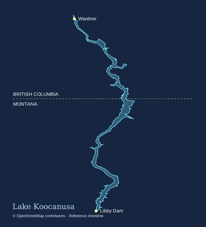
Explore the reservoir from Libby Dam to Wardner. Find launches, campgrounds and landmarks, with access information from each operator.
Drag or pinch to explore. Skip to the location list.For trip planning. Use official charts and local signs on the water.
Dam · Montana
The USACE dam at the southern end of Lake Koocanusa. For public access, use the separate Visitor Center pin.
Point of interest · Montana
The visitor stop on the dam’s west side at 260 Souse Gulch Road. Confirm seasonal hours and available tours.
Boat launch · Montana
A reservoir ramp near the Visitor Center. Check current launch conditions with USACE.
Point of interest · Montana
Reservoir-side picnic and shelter area. This pin represents the shelter area.
Point of interest · Montana
Public road crossing below Libby Dam. This is distinct from the highway bridge over Lake Koocanusa farther north.
Camping · Montana
Primitive dam-project camping close to David Thompson Bridge. Check the recreation directory for current arrangements.
Boat launch · Montana
A primitive launch on the Kootenai River downstream of the dam.
Camping · Montana
Small non-electric campground on the river below the dam.
Boat launch · Montana
USACE maps a gravel river ramp beside the Alexander Creek campground area. Check the river and approach before launching.
Camping · Montana
Non-electric camping on the river below Libby Dam, with a separate launch nearby.
Boat launch · Montana
A Kootenai River access downstream of the reservoir.
Camping · Montana
Riverbank camping downstream of the dam. The listing describes non-electric sites.
Boat launch · Montana
A river ramp near Blackwell Flats Campground. This launch enters the Kootenai River.
Camping · Montana
Forest Service campground and group facilities on the west shore.
Boat launch · Montana
The ramp area below McGillivray. Its listing describes high- and low-water options. Check which is usable.
Boat launch · Montana
A west-shore ramp off Forest Road 228. The forest lists dispersed camping nearby.
Camping · Montana
General facility point for the Barron Creek recreation area. Follow site signs for appropriate camping.
Camping · Montana
A lakeside Kootenai National Forest campground north of Libby Dam.
Boat launch · Montana
Reservoir ramp near Rocky Gorge Campground. Confirm depth and access for your trip.
Camping · Montana
A Kootenai National Forest campground along the Montana side of the reservoir.
Boat launch · Montana
Reservoir access near Peck Gulch Campground. Check site conditions before towing a boat here.
Point of interest · Montana
Representative point for the climbing area along the shoreline. Use the forest’s current access information and signs.
Point of interest · Montana
Montana’s reservoir crossing south of Rexford. The pin uses the state’s visitor-site location near the west approach.
Camping · Montana
Camping and day-use facilities at an arm of Lake Koocanusa near Rexford.
Boat launch · Montana
Representative point for the ramp cluster below Rexford Bench. Check which ramp reaches water.
Camping · Montana
Primitive Forest Service campground near the Tobacco River at the north end of the Montana reach.
Boat launch · Montana
Reservoir access at the Tobacco Plains picnic area north of Rexford.
Point of interest · Montana
Hatchery northwest of Eureka with interpretive information. Confirm tour availability with Montana FWP.
Point of interest · Montana
A downstream walking stop west of Libby along Highway 2. The pin represents the visitor access area.
Camping · British Columbia
Indigenous-operated campground on the Canadian reach. Check booking, season and access with the operator.
Camping · British Columbia
A designated recreation site on the Canadian reach. Review the current provincial restrictions before visiting.
Camping · British Columbia
Approximate campground marker from the regional recreation map. Consult the operator for the correct approach and current access.
Camping · British Columbia
A Canadian shore camping area. Check current recreation orders and on-site signs.
Camping · British Columbia
A campground in Kikomun Creek Park’s reservoir-side area. The adjacent slab launch has a separate pin.
Boat launch · British Columbia
The provincial park ramp into Lake Koocanusa near Kalispell Trail Campground. Check BC Parks for seasonal access.
Camping · British Columbia
Reservoir-side campground in Kikomun Creek Park. Use BC Parks for reservations and advisories.
Camping · British Columbia
A campground near Surveyors Lake, a separate waterbody inside Kikomun Creek Park.
Point of interest · British Columbia
The road crossing near Kikomun on the Canadian reach of the reservoir.
Boat launch · British Columbia
Approximate site marker for the seasonal west-shore public launch just north of the bridge. It is separate from the BC Parks ramp.
Point of interest · British Columbia
A provincial park near the north end of the mapped reservoir. Check the official listing for park details.